About 154 minutes
Outline Studies in the New Testament for Bible Teachers — Background and Themes
Historical Textbooks
35,352 recorded words. 21 minutes difference from this book's estimate.
View Gutenberg source #41602
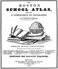
The Boston School Atlas, Embracing a Compendium of Geography — A Closer Reading can be approached with a clearer sense of reading commitment from its source measurements: 30,569 words, 2 hr 13 min estimated reading time, and 27 detected text sections.
The text analysis averages about 12.3 words per sentence, while the detected sections provide another way to judge how the source is divided.
Project Gutenberg metadata also associates the work with “Atlases,” connecting these edition facts with the source record’s subject description.
Explore this collection
These alternatives are selected using recorded categories and estimated reading time.
About 154 minutes
Historical Textbooks
35,352 recorded words. 21 minutes difference from this book's estimate.
View Gutenberg source #41602About 164 minutes
Historical Textbooks
37,495 recorded words. 31 minutes difference from this book's estimate.
View Gutenberg source #6441About 89 minutes
Historical Textbooks
20,309 recorded words. 44 minutes difference from this book's estimate.
View Gutenberg source #31639Search stored excerpts and compare books → Choose by your preferences →
Choices use stored catalog measurements. Estimates vary with reading speed. A shared category is a catalog label, not a claim that two books have the same argument or literary quality.
Search reads excerpt text stored with this catalog and links to its associated Gutenberg record. The connection is stored in the site database; this tool does not recheck that every excerpt is word-for-word identical to that external record. Excerpt search does not cover every chapter and does not verify historical publication dates.
Catalog snapshot checked: 2026-09-26. Coverage: 90 public books, 90 available source excerpts.
Calculated from edition completeness, EPUB availability, text structure and catalogue metadata. Not a user rating.
Total of 100 points, scaled to a 2.5-5.0 range. Editions with an empty description or a missing EPUB file are not scored.
Public-domain source text
The source text is kept in the dedicated reader, separate from this catalogue record and its commentary.
The Boston School Atlas (1840) is structured as a series of map exercises followed by descriptive text, with questions interspersed to test recall. The preface directs instructors to begin with short recitations before moving to map study, and italicized questions throughout serve as built-in reviews. This pedagogical design shapes the entire work, making it less a reference atlas and more a guided curriculum.
Across the excerpts, bodies of water—lakes, rivers, canals, harbors—appear repeatedly as defining features. New York is praised for its “great number of lakes” connected by rivers, and the Erie Canal is cited as a key to its commercial rise. The description of New York City emphasizes its “commodious bay” and harbor, while New Jersey’s limited commerce is blamed on a lack of “very commodious harbors.” These details are not incidental; they reflect a consistent emphasis on waterborne transport as a measure of a region’s prosperity. The atlas even includes a dedicated chart of canals and railroads, underscoring the centrality of movement and trade to the geography taught.
The text moves briskly from one state to the next, often with a single transitional sentence. After describing New York, the next section begins simply “NEW JERSEY.” and immediately contrasts its soil and commerce. This rapid succession creates a sense of a tour, where each location is briefly visited before moving on. The structure mirrors the atlas’s purpose: to give young students a broad survey rather than deep immersion. The movement is not just geographic but also thematic—from physical geography (soil, mountains) to economic activity (agriculture, manufacturing) to notable towns and historical events, all within a few paragraphs per state.
Edmands frequently uses comparative language to help students differentiate regions. New Jersey’s soil is “not generally so fertile as that of the states which have been named,” while Pennsylvania’s husbandry “is said to be better understood… than in any other State.” These explicit comparisons serve a mnemonic function, anchoring each state’s identity relative to its neighbors. The atlas also contrasts natural advantages: New York’s lakes and canals versus New Jersey’s lack of harbors. Such contrasts are a deliberate teaching tool, turning the compendium into a series of memorable distinctions rather than a flat list of facts.
The preface outlines a specific method: the teacher explains short lessons, then pupils recite. Italicized questions embedded in the map sections are meant to prompt review of earlier material. This built-in repetition suggests that the atlas was designed for classroom use where the instructor actively guides the pace. The text itself is spare, often just a paragraph per state, leaving room for oral elaboration. The structure thus anticipates a live teacher, not a solitary reader. The final section, “Questions in Review of the Compendium,” reinforces this, offering a cumulative test that mirrors the atlas’s incremental approach.
Readers approaching this atlas should note its dual nature: it is both a reference and a script for recitation. The maps are meant to be studied alongside the text, not separately. Pay attention to the italicized questions—they signal the author’s intended review points. The work’s value lies less in its factual detail (much of which is dated) and more in its method of building geographic knowledge through repetition, comparison, and a steady movement from one place to the next.
Holding that 1840 atlas, I kept circling back to its patient question-and-answer lessons about rivers and canals—so much quiet faith in young minds. It made me think of the broader story of how such books came to be, and I found myself grateful for A Brief Account of the Educational Publishing Business in the United States — Themes and Context, which feels like a conversation with that same earnest world. A small, unexpected kinship.
Answer a few questions and save a private reflection on this device.